


Creation of a hydrodynamic-numerical 2-dimensional flow model in the area of the Hillebach dam and calculation of several flooding scenarios
Project Data
| Duration: | 01.12.2023 to 31.05.2024 |
| Coordinator: | Univ.-Prof. Dr. Jorge Leandro (Details) University of Siegen Research Institute for Water and Environment (fwu) Paul-Bonatz-Str. 9-11 57076 Siegen jorge.leandro@uni-siegen.de |
| Project management: | Taylor Johnson, M.Sc. |
| Project staff: | Dipl.-Ing. Jörg Wieland |
| Client: | City of Winterberg |
Description
The Hillbach dam is located about 5 km north of Winterberg in the Hochsauerland district (see Figure 1).
As part of an in-depth safety review, it was determined that the dam has a residual risk of damage if the design flood BHQ2 (= 5000-year event) is exceeded.
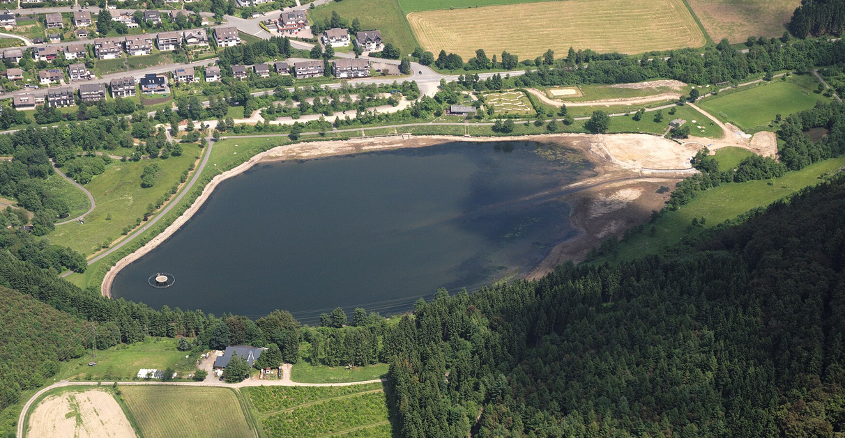
Figure 1: Aerial view of the Hillebach dam with houses in the village of Niedersfeld (view to the east; source: Wikipedia.de)
For this reason, an inflow of the probable maximum flood (PMF), which the dam is unlikely to be able to control, was also included in this review. If this inflow were to occur, it would lead to overflowing of the dam crest and destruction of the dam through progressive erosion. "It was agreed to implement an alarm plan coordinated with the disaster control department of the Hochsauerland district (HSK). This has been done, but the HSK still needs plans showing which property areas will be flooded due to a theoretical dam burst in the lower reaches." (Quote from Stadtwerke Winterberg, 2023).
The Hillebach flows into the Ruhr about 1 km downstream of the dam. Two different initial conditions are to be investigated for the dam failure scenarios:
a) The Ruhr is only at medium water at the time of the dam failure
b) The Ruhr carries a very rare flood HQExtreme (=HQ1000) as a stationary flow at the time of the dam failure
For the project, a multi-dimensional calculation model of the Ruhr valley from the dam to below the village of Assinghausen is created from the existing DTM terrain data and additional cross-sections. The load cases of progressive dam failure are being investigated as part of the project. For this purpose, breach geometries are integrated into the model according to the literature (or optionally according to the client's specifications).
Based on the modeling of the breach of the Hillebach dam, a "worst-case scenario" is also investigated. This simulates a "sudden disappearance" of the entire dam body. With the help of this load case, the maximum possible extent of the flooding area below the damaged dam can be estimated.